MVPC welcomes latest team members and adds critical skillsets to the team which bolster capacity and expertise.

MVPC Welcomes Latest Team Members to Build Capacity
read more

MVPC welcomes latest team members and adds critical skillsets to the team which bolster capacity and expertise.
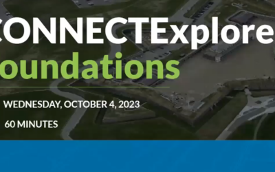
Access the recording of the training hosted by MVPC and conducted by Eagleview on the aerial imagery platform, ConnectExplorer.
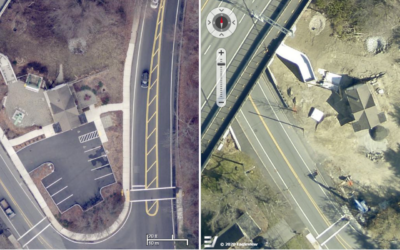
The 2023 aerial imagery acquisition has been deployed to MIMAP after being captured this past spring, marking the start of flights biannually.
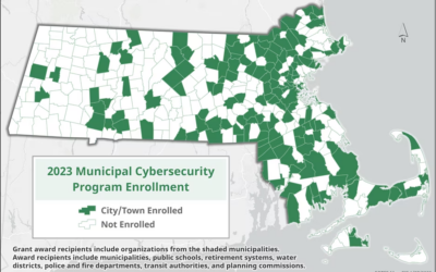
MVPC is pleased to announce we have successfully completed the Municipal Cybersecurity Awareness Grant program.

MVPC was awarded the opportunity to participate in EOTSS’s Municipal Cyber Security Awareness Grant program to enhance our protocols.

MVPC welcomes Joe Barmashi, the GIS Specialist and Hanna Mogensen, the Coastal Resources Planner to the team.
North Andover stepped toward climate resiliency with the adoption of the Multi-Hazard Mitigation & Municipal Vulnerability Preparedness Plan.

MVPC welcomes Aaron Hume as the new GIS Technician and member of the MVPC team. Welcome Aaron! We look forward to working with you.
Check out MVPC’s monthly Regional Review for the latest Grant announcements and activities including upcoming virtual online events, meetings, and workshops in the Merrimack Valley.
Check out MassDOT’s Virtual Transportation Innovation Conference. MVPC will present our updated pavement management strategy and synchronicity with our GIS ecosystem at the MassDOT Innovation Conference.